One of our goals with this blog was to share some of our favourite local routes, and encourage you all to head out and explore where you live. So this post is long overdue and features not just a single route, but covers all of the various trails you can explore on Moncrieffe Hill. Situated just to the South of Perth and overlooking Bridge of Earn, Moncrieffe is our local hill – in fact I can get from our doorstep to the top in under 20 minutes and have run up, down and around it countless times!

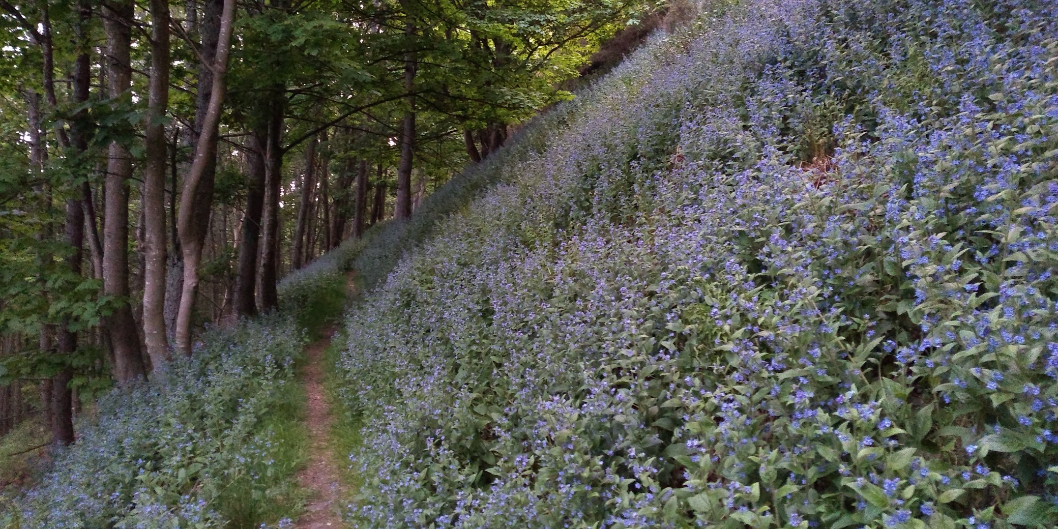
At only 223m (732 feet) high it’s not the biggest but since it’s right by the banks of the Tay and Earn you tackle it essentially from sea level, and with no nearby peaks it is classified as a Marilyn. There are plenty of interesting things to be found on the hill, besides great views all around – over Perth and Kinnoull Hill to the North, over Strathearn to the South as far as the Lomond Hills and the Ochils, and along the Tay to the East. There are sites of two Iron Age forts at the main summit (called Moredun top = gaelic for “Big Fort”) and the lower Western top, at least two disused ice houses, various wooden sculptures (the giant spiders are particularly fun to encounter at night!), and lots of wildlife. Especially if you are out at dusk, you have a good chance of encountering deer, squirrels, foxes and there is a badger sett – although the badgers remain elusive! Depending on the time of year, you can expect to see snowdrops, wild garlic, bluebells, forget-me-nots and a wide variety of woodland plants. Apart from the very top, the hill is covered with mature, mixed forest and is managed by the Woodland Trust, who maintain a network of paths, car parks and waymarked routes. Early this year, they have just resurfaced many of the paths with fine gravel, making them more accessible, as well as renewing all the trail marker posts.

Access to the hill is via one of the two car parks / trail heads off the Rhynd Road which runs right round the Eastern end of the hill. The larger car park (Tay) is at the North, and the smaller (Earn) is to the South. Both have bike parking too – although many of the trails are perfectly suited to mountain biking as well as walking and running. There is a downloadable trail map, as well as maps at each of the two car parks, but there are also a wide range of unmarked, smaller paths to be found – as well as the possibility of going off trail into the open woods. One word of warning though, it’s best to save venturing off trail for the winter and early spring when the bracken and nettles are low to reduce the chance of both stings, and being bitten by ticks which are very common – check your legs when you get home! Below you can see my Strava heat map – which covers pretty much all of paths that exist, but I’m sure there are a few more still to be found if you look carefully!

Blue and White Trails
Starting from the Tay car park, the Blue and White trails are short loops (approximately 1.8 and 2.6 miles, respectively). After following the wide, winding trail up from the car park, the Blue trail makes a short loop on a good path, passing several of the sculptures, before returning down the main access path to the car park. The White trail ascends further via slightly steeper paths and passes close by the main (Moredun) and secondary tops. It’s easy to step off the main path if you want to go right to the tops, which provide great views over Strathearn to the South.
Yellow Trail
The Yellow trail extends the White trail to a total of 4.6 miles by adding a loop out to the East. There are two roughly parallel paths that run along the top of the Eastern ridge of the hill, and back along the bottom, several hundred feet lower (or vice versa). The path connecting these is steep and straight at the Western end, and a slightly shallower zig-zag at the Eastern end. This route covers the majority of the major paths and is a good way to familiarise yourself with the whole hill. It also has around 900 feet of elevation change, so is a good workout for both climbing and descending!
Unmarked Trails
Besides the main waymarked trails, there is plenty more to explore! One suggestion (following much of the former red route), starts from the Earn car park at the Southeastern end of the hill. Climb the wide track for about a third of a mile until it joins the yellow trail, and follow this straight on. Where the yellow arrows point up and right, continue straight and follow an undulating track all the way along the bottom of the hill. After a mile, the track drops down towards the motorway and just before reaching the edge of the woods, rises back up to the right and round the Western flank of the hill. At a major track junction follow the signs for “Hill Forts” and you’ll arrive at the lower of the two summits. A choice of paths now leads on towards the main summit. Descend back to join the yellow trail and follow either the upper or lower branches back to the Earn car park.
The Rhynd Road and A912 loop itself also deserves a mention. At 7.5 miles and with 450ft of climbing concentrated to the North side of the hill, it makes a challenging road run. For me, getting round in under 1 hour is a good benchmark to aim for! On the South of the hill, there is a long flat straight which has official “measured kilometer” signs on it, making it agood location for interval training – but beware of fast cars!


Alternative access routes
There are a couple of good short cuts available to get onto the hill either from the Perth (North) or Bridge of Earn (South) sides. From Perth, follow the Rhynd Road, and turn off right into the driveway signed “Upper Tarsappie”, approximately half a mile before the Tay car park. Follow the drive between two houses and go straight ahead through a gate. A path follows the edge of a field straight on before a gate leads in to the woods. A short distance ahead, the path meets the Blue, White and Yellow trails and you can continue on your way.
From Bridge of Earn, there are several options if you want to avoid the long, straight drag along the Rhynd road to the car park. Leaving Bridge of Earn, head straight on to enter the Moncrieffe estate, and follow the road as it curves left parallel to the motorway. Cross the bridge to your right, and then you can choose from several routes. First, you can turn left into a field, and head up into the woods. A short stretch of pathless woodland leads to the main lower path, and you can head left or right before continuing your climb via one of the routes already mentioned. There is also a steep (and sometimes muddy) track which provides a more direct route, roughly straight ahead depending on exactly where you intersect the lower path. This zig-zags upwards, finishing with a steep set of steps thought a cleft in the hillside that always makes me think of the Stairs of Cirith Ungol from Lord of The Rings. Fortunately there is no tunnel, or spider’s lair to be found at the top! The stairs end on the Yellow and White trails, just to the East of the lower top. Alternatively, from the motorway, you can continue along the road, turning left at the fork, past the stable block (now converted to housing), and find a path which runs along the lower edge of the hill, behind a walled garden and several houses. Either follow this all the way along until you reach the Earn car park access road, or at one of several points choose to bash directly up through the woods to reach the lower hill path. As mentioned earlier, it’s probably wise to avoid these routes between late Spring and Autumn to avoid having to spend time removing ticks form your legs afterwards!
Other favourite spots
A few other interesting routes to mention. Firstly, there are two alternatives to the main path up to the Moredun Top. The first (which has its own Strava segment) is a steep climb up a grassy bank – fine when it’s dry but a slippery challenge when wet, especially for descending! On the other (East) side of the top, several overgrown paths converge and head down through the woods to rejoin the main upper track. A good option if climbing or descending to the East to avoid having to skirt around to the Western side of the top for the main path or the scramble. Secondly, there are two interesting little paths that can be found tucked in between the higher and lower paths towards the East of the hill. One is a steep grassy path (Strava segment) that is great fun to run down – the only question being quite how fast you dare to go! The other is a narrow path that runs parallel to the upper and lower paths, and comes out at the mid-way point of the zig-zags above the Earn car park. There is lots more to find too – so have fun exploring!